Noise

happy new year pt2

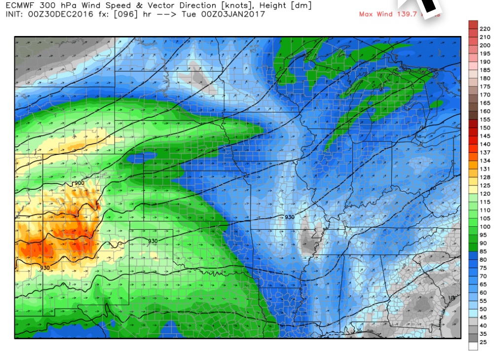
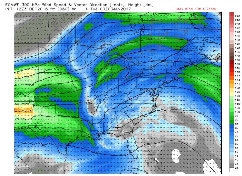
Obviously, major differences on display in both models. It is no wonder that SPC almost never outlooks any “slight” risk areas beyond three days. There is agreement on the 300mb flow between the two, with a split in the max winds over the central plains at 00z. 

The gfs has an elongated low in the plains, with another low in western Louisiana. The european has an elongated area of low pressure with a center probably in northern Missouri and no low in the south, and about 600 joules of sbcape in this area. 


The upper center is still off the California coast so things may coalesce tonight. By 00z the 500mb vortmax favors Mississippi on the two progs. What was an easy go decision is less than that today. And now there is this...

The 12z runs of both models show consistency between each other and with their own successive runs. Behold the upper flow, still showing the split in max winds.

Even when the upper low was off the coast this configuration kept showing up in the solutions. The 500mb pattern hasn't changed much either.

The surface solutions have come together with the surface low allegedly located at Olive Branch, not far south of Memphis, at 00z.

I expect only minor adjustments from here onward. The upper low is over the southwestern US so we won't have the over-water data void problems anymore, at least beyond the usual. Tomorrow it will be time to look more closely at the shear and instability forecasts for Mississippi during Monday afternoon.