Pocahontas-Gilmore City

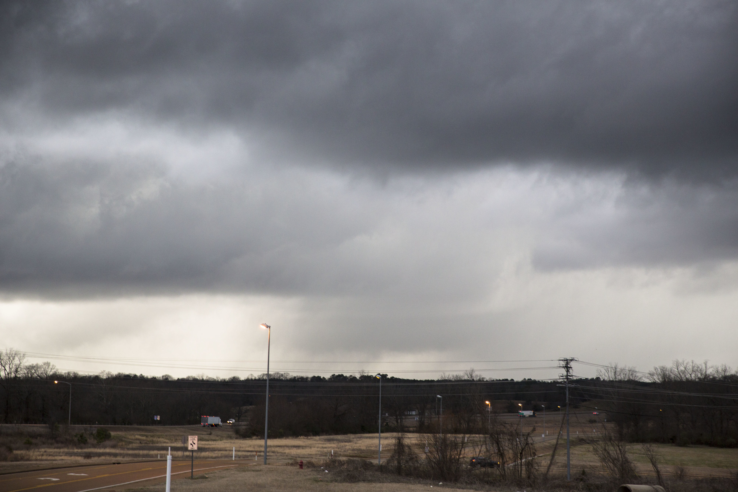
It was hard leaving St. Joe and heading north into the even chillier air. The calendar said April but the air looked like the first front in November. Low overcast, drizzle, and fog argued for heading straight west for the clear air in Kansas. Fortunately I-229 was closed. And the numerical guidance was consistent over the previous three days. I stopped occasionally on I-29 and saw the warm front heading north on the satellite loop.
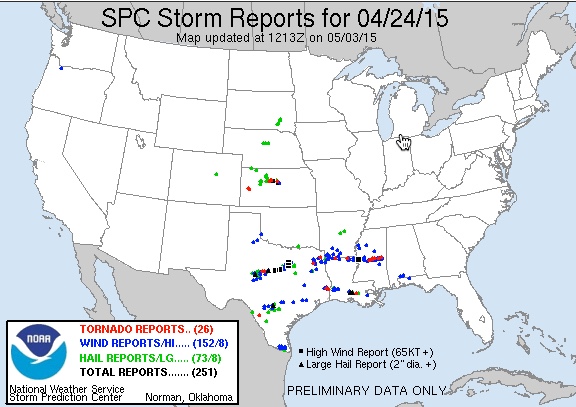
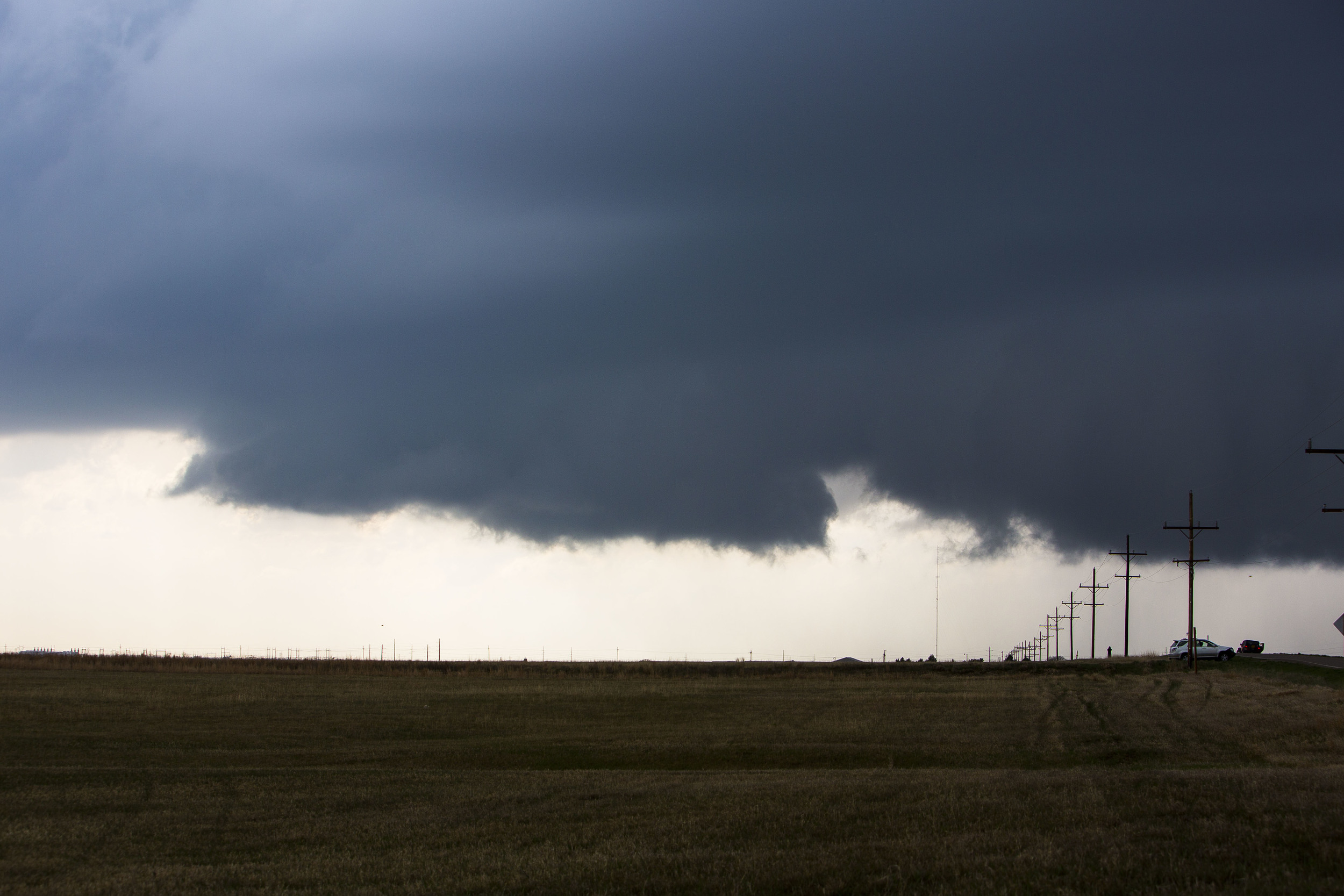
There was more road work around Council Bluffs, and then Sioux City. Eventually I watched the sun appear north of Omaha, along the Missouri River. It is a good road despite following the river. I watched radar and satellite for awhile as convection built along the warm front from eastern Nebraska into southwestern Iowa. The problem of course was the river. Committing to crossing into Nebraska meant a possible hard recovery east if things got busy. The most impressive storms were forming in west central Iowa, moving for northern Iowa so I went east, afraid that the channel of instability would be too narrow to support long-lived severe storms. The first tornado watch covered western Iowa and Nebraska’s border counties. The second watch covered the middle part of the state and this make me feel better. I drove east on rt3 toward a storm that was coming up from the southwest. I chose to plunge into the west side of the cell as it was coming northeastward in a hurry. Tornado #1 developed to my south when I was east of Pocahontas. It was a dust cloud without much of a circulation overhead.
This changed in a hurry. I shot a clip through the passenger window and then got out to set up the tripod. I extended the third leg and it detached from the support and bounced to the side of the road. So I shot hand held. No matter how stable I think I am, I’m not. But at the moment, on the plains after three chases into the woods of Arkansas and Mississippi, I abided.
Another cell smacked into the back side of this one and I saw another debris swirl southwest of me. I backed off to the east and stopped, and then the rfd hit the vehicle. Fortunately I had the vehicle’s hinder pointed into the wind. A 10-inch diameter tree fell on the other side of the road but I was afraid to move in the 70mph outflow. There was a circulation north of me, and one in the precip to the east, and probably one behind me. Even though it was only 7pm I didn’t feel safe with just one pair of eyes in the car. I exited south and listened as the tornado warnings continued well after dark for northern Iowa.
The dryline moved into the western part of the state with a line of storms. There were multiple warnings on this activity but few verified tornadoes. I stopped in Fort Dodge and unloaded the vehicle before the line arrived.