Noise

November in the southern plains

After an extended period of peace and quiet, a few features are coming together that make this afternoon and evening look interesting for western Oklahoma and northwestern Texas. 

A surface front extends from southeastern Kansas through central Oklahoma to a low that has not really consolidated near Childress. The OUN and FWD soundings look good as far as moisture is concerned and this has been a problem over the past couple of storm systems. Thunderstorms are racing into southern Kansas, well north of the front, and there is a steady clearing trend over far western Texas at mid-morning. 

The HRRR shows new development in western Oklahoma extending southwestward into northwestern Texas after 21z. The RUC doesn't look so great; precipitation is widespread over southern Oklahoma from 14z onward. The NAM is likewise wet over the entire state from spin-up, with increasing 3-hourly totals beginning after 21z for Oklahoma just east of the panhandle border, extending southwestward in to west Texas after 03z. Finally, the GFS has rain all over the state, too, especially in the north and west. Why do I look at this stuff?

Dynamically, everything is fine to very fine. No real bulls-eyes, I would focus on the west end of the deep moisture east of the surface low, wherever that ends up at mid-afternoon. Most of the models stamp the surface low in either eastern New Mexico to the southern plains of west Texas. It is kind of a baggy isobar pattern. I think the low will be around Childress or extreme southwestern Oklahoma today.

Lowest lcls are begin in western Oklahoma during the mid-afternoon. My area straddles the Red River, as I expect everyone else's does. 0-1km helicities are better up north, the HRRR storm motion vectors are out of the southwest, at around 240. I don't really know how that model computes storm motion so a right-mover birthed south of the river could stay south of the river. 

The vortmax appears to be in eastern Arizona, which looks a bit west to really have an effect during daylight. The models show the vorticity to be channeled. It might not matter with all the moisture that's waiting. It might really be good shortly after sunset. Too far for the Carnivorous Storm Team to go for night time tornadoes. Good luck to the more ambitious and geographically-favored.

Fox Weather Camp

It went better than expected. And we're supposed to encourage young peoples' interest in science, right? And it only consumed three hours. And there were no lasting scars.

So the 1st annual Fox13 Weather Camp has come and gone with no lasting damage. Not even to the Agricenter.

My department spent around $1000 for materials, including airplanes, plywood, paint, trinkets from the company store. Labor was already factored in since we had free reign to dither over this for several weeks. You never know if you got your money's worth from something like this. Response was good, as in, the kids had a good time. Whether they learned anything or not is known only to higher beings, if there are (is) any (one). (That was for the next administration, eta November, 2012.) 

The four of us spent a significant number of minutes assembling the airport simulation. We ran the video loop of flying ants converging on the Memphis airport in advance of the squall line, followed by the airborne holding phase of the evening, climaxed by the landing of the remaining aircraft after the squall line clears Memphis. That was ground school. Some people recognized what it was, others were baffled. I spent considerable time narrating. It was supposed to inspire a coherent simulation using our foam airplanes and plywood runway. There would be ten pilots, and about twenty thunderstorms for them to avoid.

Of course the kids had their own sim, in fact there were a couple of dozen going on at any moment. It was part cat rodeo and part Kabuki theater. The "storms" were participants (myself included), holding a cardboard storm image, floating in the path of the pilots. This became a combative situation at times, and I may not have helped by shouting, "There's an airplane, get 'em," at my fellow storms. Live and learn. At the end of the three hours we had three intact planes, and some of the storms were not in great shape, either. 

We rolled with the flow since we had no choice. There were only a couple of half-minute intervals when I considered a quintuple-vasectomy. Still, it was a good thing that I did not know how to do it myself. 

I enjoyed talking to mothers and kids about good schools for operational and research meteorology. I remember those days. One kid even knew there were positive and negative lightning strokes.

Fox13 is already planning on another camp next summer. They will probably have to expand the hours to allow time for waiting in multiple lines. The chroma-key stage was the main attraction and drew the most kids. We should just order a couple of thousand balsa gliders and save ourselves a lot of trouble. 

May 24th--more Oklahoma

This was the day the Institute wanted. After taking advantage of the motel's fitness center for an hour, the day's weather became the focus of the team of one.

This was one of those days. When someone writes a book about the dark side of the earth's atmosphere, he will pick a day like this to make a few key points. The dryline looked like the most promising source of carnage this day. The winds aloft would cross the boundary at a right-angle, which is optimal for discrete cell formation. Instability and shear would be abundant up and down the dryline, which the Institute hoped would spread the chase hordes out. The only downside to the setup was the possibility that the Oklahoma City metro area would hamper the fun. 

SPC was enthusiastic. They forecast a 45% chance from the Oklahoma-Kansas border to the Red River of a tornado occurring within 25 miles of a point. This seems physically impossible, and the Institute wonders if this has ever happened over such a large area before, but we liked the government's attitude.

The Institute follows federally-mandated strictures regarding separation of church and state, but we prayed to every deity we could name to not be too stupid. From the day's point-of-origin in Perry, Oklahoma, we watched the Gulf stratus thin out as the morning progressed.

Parameters were so good that any updraft that formed along the dryline should spin its hinder off, but we preferred west central Oklahoma for initiation. The forecast storm vectors took such an updraft into the City, a bad outcome for so many reasons. But as Colonel Potter said, you have to hit what's pitched.

If Comfort Inn offered 1pm check-out times we would have been delighted. As it was, we had to start loading the vehicle at 10:30 to be out by 11:00. A couple of friends called in the middle of this process. They had left Memphis early in the morning and thought we would be in the neighborhood. We decided to join up for the day and left the Institute's car in Perry.

By early afternoon the push was definitely on from the panhandle. The dryline was near Gage down to west of Clinton. We felt we had plenty of time but left for northwestern Oklahoma after 1pm.

Our storm formed near the interstate and moved northeastward. We stopped near Canton Lake to consider the road options, which were sub-optimal due to the lake. We continued west to the gust front, then retreated. As we did this we saw new rotation to our south that intensified rapidly.

We had to pause for congestion around the Dominator, which worried me since the circulation was almost directly overhead. The funnel developed and hit the ground a couple of minutes later. We shot stills and movies as  it moved northeastward across the lake. It hit a trailer park and trashed a lot of trees, then continued into Longdale, killing two. 

We had let it go by this time, expecting another storm to our south. We got caught in precip and slow traffic. Around this time the storms west of OKC had our attention but it would be a rough intercept through the city. 

The accounts on fm radio were harrowing since the tornado was plowing through the crowded northwest side of the city. I expected I-35 to be closed by the highway patrol, but we made it to the Guthrie exit, in the path. 

Despite being less than a mile off, we could neither see nor hear the tornado through the core. The damage survey showed it lifted at the interstate, north of our exit. We continued eastward but never saw any touchdowns to the north. We missed the other big storm that passed near Norman and went on to Shawnee.

So our tornado at 3:30 was it for us. Some people did worse, some did better. I was glad we were not too aggressive going into the core, even if it wasn't my vehicle. 

We maintained vigilance until just before dark, then had dinner at a Braum's. Even with missing the OKC area tornadoes, we were pretty impressed with ourselves.


May 23, 2011 -- Northern Okla.

The dryline was out west, the warm front was in northern Oklahoma. Unfortunately the wave came and went early, so we were left chiefly with afternoon heating for lift. As the morning storms crossed northeastern Oklahoma, new cells formed near I-40 out west, and finally, west of Enid, where we were waiting. The individual cells quickly turned into large wet, messy congealed globs. There were tornadoes (brief, of course) reported, but not from credible observers. We saw tape of a landspout near Fairview. The whole mess dropped a lot of rain over northwestern and north central Oklahoma, with flooding the biggest problem.

We got to have a brief chat with Sean Casey at a Dairy Queen but did not see them the rest of the day. There were more discrete cells south along the dryline. Maybe they did better. We saw few chasers once the storms began. This was the most intense daylight lightning display in memory. We let the glob go on its way to eastern Oklahoma. The mammatus at sunset was beautiful.

May 19, 2011--Sylvan Grove

We started the day in central Oklahoma. Southern Kansas was our first guess, not wanting to get too close to the boundary. Storms formed around midday in western Oklahoma and northwestern Texas. We were not fooled into turning around, but it was a bit of a surprise. As the afternoon wore on in Pratt it became evident that the area was not ready, while satellite pix showed a good boundary from near Russell into Wichita. As we left Great Bend a couple of cells formed. There were already storms up, north of the boundary north of I-70. A storm northwest of Great Bend improved and hailed on the Bunker Hill interchange. Someone claimed there was a tornado near Dorrance but we did not see it. 

We went east to in exit of I-70 that went up to Wilson Lake. The storm showed some rotation and a couple more tornadoes were reported that may or may not have been real. The inflow as we skirted the lake was terrific. We stopped on the north side of Sylvan Grove and watched a meso come right to us. The motion was incredible and we had everything but flying livestock. The circulation wrapped up in precip northeast of Sylvan Grove and reportedly hit the ground, though there are no pictures from the hordes present. It just wasn't that kind of day for a long-track tornado. We checked out a couple of more circulations but saw no tornadoes.

May 11, 2011 -- Pretty cirrus

We had been hoping for rain over the high plains. Who needs grass fires? But we're as attention span-limited as the next institute. So when we awoke to what was to have been a promising day and saw the color-crammed radar over the southern plains, we remembered that old saw about being careful about what you wish for, or something to that effect. We had been hoping for a reason to head to southwestern Oklahoma but had to concede that the incoming wave would likely not reach down that far south as it turned the sharp corner to the north. The poky convection killed the rest of the state so we were forced north to the triple point in northwest Kansas, with the rest of the hordes. That didn't work either. We're glad it rained out there. Really. Rain good. But why this day?

Last week of April

Taking care of old business on a slow day...

Tornadoes blitzed St. Louis and various suburbs Friday evening. Lambert Field was badly damaged and closed for about 24 hours. Anyone not residing in the damage paths would enjoy the radar loop of the proceedings. There was another line of storms, hailers mostly over southeastern Missouri during most of this time. 

As Monday dawned the stationary front has made it into southeastern Missouri, focusing much of Saturday and Sunday's convection away from STL. Some locations in northeastern Arkansas have received more than ten inches of rain. Wish it had landed on the high plains instead. 

Severe storms are crossing Arkansas this morning; the Institute heard thunder at 3am but the storms caused no trouble. The front will be around the mid-south through Wednesday morning. The jet is going to be in the neighborhood as well, and this could be exciting regardless of the time of day or night. After dark Tuesday night looks especially stimulating. Memphis and environs will be under the right-rear and left-front quads of jet maxes. Dangerous, for those who will have survived the rains that will have fallen in the meantime. 

But back to Monday. Due to circumstances beyond our control we cannot be east of the triple point in northeastern Texas this afternoon. The cape is not great but is good enough, and there will be some diffluence aloft to help ventilate the updrafts. The front will be well north of Memphis, up in Missouri, so the Institute will sit this one out.

April 14 in southern Oklahoma

Apr 14, 2011 Southern OK

The Institute set out for north central Oklahoma, the original target, at 0500hrs. You have never had your soul sucked out of your body until you have done the trans-Arkansas sprint. Fortunately much of this was done in the dark.

Upon reaching Webbers Falls for food, gas and data, the forecast team quickly concluded that a new paradigm for the day was needed. The favorable parameters were largely converging over central Oklahoma, east of Oklahoma City, southward to just south of the Red River in north central Texas. LCLs were more favorable, the upper flow relative to the dryline's orientation was better, the jet axis would be over or just south of the River. At the surface, the best heat was coming into south central Oklahoma from Wichita Falls, and the best westerly push was over the southern Texas panhandle and the south plains, surging toward southern Oklahoma.

The moisture and better flow normal to the dryline were among the more persuasive arguments for going south. Trees and terrain would be the primary obstacles. Where we originally thought there was a 100% chance for tornadoes and an 80% chance of seeing at least one, the southern option's prospects were 100% and 40%, respectively. Sobering, but with the workload split among two members it would be doable.

We proceeded west on I-40 to Shawnee and turned left. SPC issued the first tornado watch for Kansas, and then one from the Oklahoma-Kansas border to a tad south of the Red River. FIrst cells fired near I-35 at about 20z.

We awaited the cell's arrival on the south side of Ada. The original cell movement was surprisingly northeastward rather than east-northeastward at first, but this changed during the late afternoon and evening.

Finally had to commit to the storm near Sulphur as it got better and better on radar. It was tor-warned but nothing was confirmed. In fact as other echoes developed they would occasionally look promising, but not for long. Finally a confirmed tornado landed near Madill and the hook was beautiful. We could not get down to it in time because we did not want to punch any cores with large hail expected. Another storm came up from the the southwest with a terrific bell-shaped updraft. We took pictures while marble to golfball hail fell around us. We considered that a success.

Taking pretty pictures cost us because the storm cut us off. It was periodically trying to spin but nothing imminent seemed likely, so we went south and then east. The longer version would include repeated questions of "I need a road that goes____," followed by the response "You can't have one." 

So we were away from the storm for about 40 minutes as we dropped south and then east and then north up the main highway into Tushka. South of the town the suv in front of me make a banzai right swerve to go to the shoulder and I could not see why until I had already hit the power line draped across the road at eye level. At that point I decided to continue north to catch the circulation that seemed to be over the east side of the little town. At 7:28pm we saw a blue satellite tornado condense on the southeast side of the main meso. We could not see ground level so we missed the debris. But as we entered the first intersection in Tushka strong westerlies scooped up pieces of something--dramatic. But by this time only the outer periphery of the circulation was over Tushka. We saw damaged houses, an overturned semi, downed lines and busted trees. We gingerly made our way north having not seen anyone who needed assistance. In fact I can only remember two people outside in the whole town, and they were calmly surveying the damage.

We got back to the main road and headed north, but saw nothing tornadic to the east. Warnings continued. The fm dj we were listening to for warnings apologized and abandoned the station to look for his brother, who's house had been hit by the tornado. He left the station on auto-twang and we heard no more warning information. 

Emergency vehicles sped southward toward Tushka as we approached Atoka. Eventually we had dinner in McAlester and proceeded back to I-40 for the trip back to the Institute. 

The return trip across Arkansas was plagued by the developing mcs that gained strength and sped up as it traversed the Natural State. At 50-60mph and producing damage, it would have taken eternity to punch through, so I rested a couple of times to let it move on. Tornado warnings continued as the line reached eastern Arkansas. It was still creating carnage in eastern Arkansas at around 4am, killing one person in St. Francis county in a mobile home. We were glad for the end of this long rough ride.

Looking at the video from others, the best view was westnorthwest of the circulation from a group who took the Boggy Depot road that looked questionable to me. It went right into Tushka on the west side. They got some great stuff. Someone else southeast of the town got a nice clip as well. One of those days when sedan chasing made a big difference If the terrain and trees had cooperated we would have seen a large debris cloud, too. Still a success in some regards. Looking at the radar loop, this could have turned into a whack-a-meso battle. Another good forecast, but I cannot cure the world of trees and hills.


April 3, Iowa again

The Institute's mobile unit left Memphis early in the morning and reached northern Missouri in plenty of time. Parameters centered on two areas: north central Missouri and southern Iowa, and southwest of Kansas City. Storms fired late in the afternoon and built southwestward from eastern Iowa.

I was afraid to go to the Iowa low because of the moisture. That took away the best shear, and much of the rest of the area was in southwesterly winds. Model shear values still painted an encouraging picture. I finally chose south central Iowa where storms formed around 5:30-6pm. The first batch was a cluster that crossed east central Iowa. Storms built into northern Missouri through the evening. One cell went up northwest of Topeka early and hailed.

All in all, no tornadoes reported; in fact, no tornado warnings went out that I could find. Large hail reports were common, but I avoided the stones. I photographed a storm allegedly producing 70mph winds and then got out of the way as the last light faded. Lightning was not great. 

I had a rough ride in southeastern Missouri and northeastern Arkansas the next morning due to heavy rains and strong winds. Then the storms rolled over the Institute and we lost power for over a day.

March 22, '11 in Iowa

The surface low began the day in eastern Nebraska with the warm front to southwestern Iowa and northeastern Missouri. Lots of skepticism on the board about this one but I thought storms would develop, at least in Iowa. My area was south of I-80 and west of I-35. Probably should have driven there.


I left KC after lunch and went up I-29. Around 2pm I checked radar and saw a cell had popped up southwest of Concordia, quite a bit earlier and further west than I expected. I had rejected the dryline in Kansas because parameters for tornadoes were so weak, but I wanted to see what the storms looked like so I went west from Rock Port into Nebraska. I magically thought I could take a look and then hop right back into western Iowa for the good stuff. 


I took pictures and a short movie, difficult with the wind blowing the tripod over whenever I was not looking. The tops were flat and visibilities in the airborne dust were not great. NWS issued warnings for hail as I packed up and returned to northwestern Missouri. 


In addition to 50+ mph cell movement, the storm did not have to follow any roads. It made excellent progress northeastward. That cell, and another northwest of Omaha, began torpedoing a little before 5pm and the rout was on. Adair, Union and Madison Counties got the bulk of the vortices and I probably could have made it had I floored it for an hour. I drove somewhat reasonably and caught a storm near Lamoni that funneled and rotated for a time before dark. It was the northern-most storm to not produce a tornado in Iowa.


So it was mostly what I deserved. There were at least a couple of really good tornadoes that I am sorry I missed. Otherwise the day was a dust storm with tornadoes tossed in. Great forecast, then another breakdown on the meso-alpha scale.

Chicago Aviation Weather Workshop

Turns out that airspace is as valuable as real estate. The National Weather Service is trying to help the FAA and the airlines use it more efficiently at all times, but particularly during bad weather. So they hosted a meeting of the different agencies and carriers at Lewis University in the Chicago 'burbs.

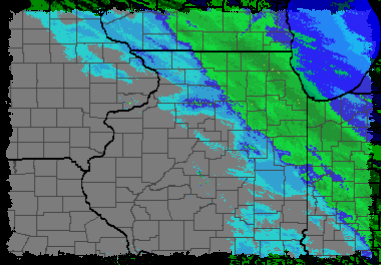
Amid a memorable winter, the snowstorm that crossed the Chicago area on December 20, 2010 was not especially strong. The city’s two largest airports received two to three inches of snow, and the timing and amount of precipitation were well-handled by the traditional forecasts issued by the local NWS office.

Even so, it was an expensive evening for the city and the airlines. After gorging on caffeine and doughnuts, representatives of UAL and SWA revealed the truth of their companies’ failures during the night of study. UAL had numerous diversions since they had expected an acceptance rate of 48-56/hr, which was for a time 48-56/hr too high. SWA had zero diversions but made numerous overflights, which is not a diversion in the same way that a sort conducted without kilos of late packages is not late.

SWA has a policy that they forbid travel by unaccompanied minors during weather disruptions like this one in order to avoid ugly confrontations with angry parents of missing children. It cuts down on Amber Alerts.

Al Perez of O’Hare City Operations is the manager in charge of snow removal at ORD. He once held the same position at MDW and has been doing this work for decades. His goal is sort of a “no runway left behind” ideal where closures are brief and affect as few runways as possible. It is not uncommon for different parts of the airport to experience different precipitation rates and this adds to his tactical planning load. He has trained his group to use the wind to help remove snow. He also considers moisture content since he can omit the anti-ice treatments if the snow is dry enough (20:1 to 15:1).

He shared his appreciation of the challenges along with the pieces of information he could use to make his job easier. Perez currently has four sources of weather information, including one person from UAL who goes to the tower as a consultant. He discussed his suffering from the obvious complication of enjoying multiple sources of forecasts. Oddly his next remark was that he was considering hiring his own meteorologist to add to this mix.

Principal expenses are people and equipment, naturally. Total costs from the December 20th storm was around $10 million. Bad manpower forecasts result in added costs, whether he has too many or too few. The night before this conference the forecast called for three to five inches but only .2 inches fell. If the forecast had verified he would have spent $250 thousand less than he actually did for the dusting.

Perez cares most about precipitation start/stop times, temperatures and wind direction. But the biggest shortcoming in his information is detailed snowfall rate forecasts through the course of a storm. He said this would be especially helpful for planning equipment usage.

Personnel from ARTCC, TRACON, and the ORD Tower presented their complex range of issues from the traffic management perspective. Their most difficult problem among many is planning for brap/bran reports. The city closes a runway on the first bran report and the tower people have a rule of thumb that two brap obs rapidly lead to a bran report.

Putting a stop to landings means takeoffs have to be stopped due to all the aircraft holding.

The tower needs 15-20 minutes lead-time for turning the airport around. If they get that, the operation is no big deal.

Traffic flow is affected by where the planes exit the runway.

They expressed their wish that tafs and metars evolve into more useful sources of information, in the spirit of NextGen. This led to a discussion of restrictions on what can and cannot go into a taf and a metar, due to the WMO.

Like Al Perez, the people who came to the workshop from traffic management clearly enjoy solving problems.

Lewis University’s dining hall followed this with a terrific lunch. That was fortunate since the featured luncheon speaker read every PowerPoint® slide verbatim. It is possible that Lewis is affiliated with the Reading is Fundamental program. Anyway, the food was too good to throw.

The broad picture I got throughout the day was that the NWS has a hodge-podge (I mean this in a positive sense) of local initiatives that deal with problems specific to different terminal areas. Some of these also address enroute matters. 

A probabilistic snow accumulation program for Denver is in its third year. This was a result of DIA Ground operations struggling to extract more information than was possible from the traditional taf. The technique relies on the SREF and was developed by the SOO at NWS Boulder. It is available at http://www.crh.noaa.gov/bou/?n=aviation.

The majority of delays in the NAS arise from the NY/NJ/PA airspace. A similar aviation conference hosted by NWS  in New York highlighted the lack of coordination between the airlines, FAA, and NWS. NWS conducted a 60-day demonstration to enhance weather services by dedicating an aviation forecaster to planning telephone conferences. Customer feedback was overwhelmingly positive. They have found some success in using Bufkit’s momentum transfer product in forecasting gusts at the surface. It takes the thickness of the boundary layer into account when determining how much of the energy mixes down. Science.

In Atlanta, tafs go out every two hours. They are using NWSChat, and emphasize forecaster confidence in each afd.

Chicago has put together a one-stop website for aviation customers. They showed how forecasting deep, moist convection only at arrival and departure points can be misleading for the terminal area, so they are revamping that product. They have an experimental winter precipitation outlook with hour-by-hour parameters and a discussion. http://www.weather.gov/zau.

AWC in Kansas City summarized their voluminous offerings along with changes that are upcoming. Bar bet: the number of convective sigmets, around 30,000 annually, is their only product that outnumbers the CCFP (25,000 polygons served each year), which survives bafflingly under a shinier acronym.

These efforts are done with an eye toward the megacolossal NextGen project and will test some concepts and products in advance.

The mets at the Romeoville NWS, adjacent to Lewis U., have learned a lot from the planning phone calls. That office added three forecasters who have been cross-trained in CWSU operations. They also have an Aviation Services Improvement meteorologist.

Their postmortem of the December storm made them realize that visibilities alone told them little about the snowfall rate. ORD reported SNINCR during two separate intervals but the visibility never fell below 3/4sm. They speculate that smaller flakes yielded a better visibility during the heaviest snow. They are going to study this possible relationship. I suggested they include sleet in their work but that precipitation type does not fall for long in their area, climatologically.

This was an exceptional workshop. It was one of the few times where a faces-to-faces gathering made sense. The material presented was not just a re-hash of Powerpoint slides, mostly. 


Sunday

So I had a brilliantly incisive post that covered all the intricacies of the day's potential, and then I didn't. I short, this morning it appeared that the cap would be broken in eastern Arkansas and there would be daylight tornadoes for the masses. The vis imagery showed a clearing trend over the southern and eastern sections of Arkansas that oozed into Mississippi. SPC graphics showed an axis of good mlcape through the delta. The best dynamics and shear extended from south of Little Rock over to northern Mississippi. 

An area of storms formed nearly overhead of the Institute at midday and sped off into the sticks. Radar showed an area of echoes oriented nw/se from western Arkansas to the Arkansas-Louisiana border. I thought something fresh would develop southeast of Little Rock, ahead of this mushy area of precip, but it did not. Then I thought the mush might get better as it moved into the better environment, but it did not. 

My original area looks good, but nocturnal as I expected. There is a fine cell near Coffeyville, with a tornado warning on it. The institute will get nailed after midnight. My 24-hr forecast was better than the 4-hr, at least for this area. Not unprecedented. Might be a rough night for the cat.

The Very End of February

A cause for celebration.

I like consistency in my computer model output. It would be nice if they all agreed with each other, but at least the nam and gas are sticking with their earlier opinions. The nam says it is hopeless for any daylight severe Sunday, and the gfs thinks eastern Oklahoma and northeastern Texas will go during the afternoon. 


The wave at 500 is still in west Texas at 00z on both models. And each has the jet split along the Kansas/Oklahoma border at 00z. Given the early sunset, though things are improving on that matter, I will probably sit this one out. Even if something fires during daylight it will soon be in the woods.


Which brings us forward to what's already happened. The SPC log has 22 tornado reports from Thursday, 21 after sunset. Some had real damage associated with them. Bad timing for people who didn't want a tornado and for those who did. Tombstones were pulled out of the cemetery near Parsons, Tennessee. Hmmmm…


As for me, I saw snow but not as much as I had expected. The Aviation Weather Conference in Chicago was actually very good. Traffic managers, meteorologists and snow removal experts shared tales of woe and exhilaration. I think everyone felt better after realizing that everybody was suffering through this winter. Lewis University, which I had never heard of, is a big deal in aeronautical education. If I had time I would take advantage of their online courses. As it is I'm happy that I could take advantage of their dining room. Back to the models.

The dregs of February

Tuesday, Feb 22


The 12z and 18z models show a busy very early Thursday morning for the area with elevated hailstorms and lots and lots of rain. Then the main event, possibly tornadic, coming later in the day. The European model is faster than the gfs and takes better advantage of the diurnal instability. It looks like Arkansas has a better chance for daylight tornadoes than western Tennessee and Mississippi. By Thursday afternoon the ecmwf is a couple of hundred miles further northeast with the surface low, in northeastern Arkansas, than the gas. This could be crucial for anyone wanting to see a February tornado.


Another weather problem this week involves Chicago for Thursday through Saturday, since I'm supposed to be there for a workshop. Given the severe weather chances down south I'd rather not go, but I'm not self-employed. The European model gives Chicagoland a rough few days that I would rather miss, no matter what happens in banjo-land. Still, there is Giordano's pizza, with 55 locations in Illinois and Florida, all of them conveniently located near me. Huh?


Anyway, the nam shows heavier precip between 6z and 12z Thursday to the north of Memphis, but the gas also suggests a busy early morning. During the day the nam has the warm front along the Missouiri/Arkansas line into Kentucky. Both paint a busy picture for Memphis from 0z to 6z but the nam is pouring more rain to the north.


What is the storm chaser, who prefers his tornadoes before dark like any decent American, to do? Wait and decide Thursday morning, that's what. 

3rd week of February

This is more like it, as much as I like chaos. Most of the US is enjoying a lull for a few days. The Pac NW and northern California are getting hit; that's alright. Inane phone calls and email have plunged to normal levels and we can get some work done. 

 This week we're watching the birth of compressionology, the application of science and arithmetic to forecasting aircraft arrival rates. So nice to see original and intelligent work getting done. Should have gone into the national weather service when I had the chance.

 Models show a storm crossing the plains early in the week, moving to New Jersey after that.  Memphis looks too hot for ice and snow so it won't be too bad in the mid-south. For now, we dance.

second week of February

We've waited for this event (ugh) for about five days and so far it's going about as planned. Schools are down, the Y is down, I'm in booth #12. I thought we would see 3-4 inches but it may be closer to 6 when it tapers off this evening. I forgive the Y on this one. G'town P'way is crawling on the southbound side. May ride this commute out right here. One village in northeastern Oklahoma got 25 inches; another in northwestern Arkansas got 19. This is a real snow storm anywhere. Little Rock popped up to 3 miles a bit after the hour (3pm), so the end of the accumulating stuff isn't that far away but there is or are a couple of hours of good flakes to come. Each one weighs about a pound. It was interesting that the HPC guidance backed off on our prospects for four inches this morning. All through the wait for this event (ugh) the gfs was less enthusiastic than the nam as far as qpf's were concerned. At least we could assure the hillbillies at the airline of the internet that it would be measurable. I would bet a large Coke™ that we will only have light intensity snow here at Suite 114 from here on (4:10pm). If we got anything wrong, it looks like it will be the early departure of accumulating snowfall. I'm fine with that.

We here at the Institute worried about the weight of God's fluffy gift on our roof, til we remembered we didn't have one. Forward, to our doom. We will work from home tomorrow and give thanks.

Fri p.m.

(Booth 12)  We put snow in the forecast yesterday but decided to go with a rain/sleet mix this afternoon since morning temps were breaking the mid 30s. Dewpoints were still in the low 20s, which was a concern, but there was time to remedy this. Then we started snow for the airport aft 01z, accum around an inch. The NWS is more enthusiastic but we decided not to rubber band the forecast. I say we, since the 3rd floor dolt du jour punted the forecast upstairs. My initial inclination was to ask him to go home and not return but cooler heads won that argument. 

So we are 39/27 at 3pm, radar shows a mass of what is probably rain/sleet/freezing rain in eastern Arkansas, coming toward us. The precip will probably cool us to freezing shortly after dark and then the fun begins. Still doesn't look like a major deal. Especially when the ensembles are painting a gloomy picture for Wednesday. Multiple inches, it appears, then the coldest air of the season. We are the atmosphere's bitch for the foreseeable future. The Ft Useless sort may resume someday.

Verdict: It sprinkled on me on the way from the Y to booth 12, so I expect further cooling in the low levels and we will transit from liquid to freezing to frozen. But I will defy NWS and stick to 1 single inch of snow by morning. But that could be the Dogfish Head talking. The primary question is: will Suzie make it home in a timely fashion from Kansas tonight? That's beyond the realm of holistic and cognitive meteorology. Dang.

Wed. a.m.

Chaotic around hindquarters yesterday and today isn't much better. Memphis got flurries but after they were removed from the forecast. Indianapolis got its ration of ice, and it looks like Newark will miss much of the snow as winds are off the water. Someone ordered 36 pizzas to celebrate our doom and the floor reeked of pizza sauce. The best news is that I-70 is open west of KC. 

Winds here last night restricted arrivals to one runway for a few hours which didn't help matters. Still windy, actually, and blizzard warnings continue from eastern Iowa to the western Gt Lakes.

A grand total of one tornado yesterday, in northeastern Texas. If the moisture had come north it might have added something to the day down south. I guess the Gulf has been well worked over this season.

Snow will be back to this area Friday night and early Saturday, according to the gfs. Might actually be measureable this time. 

Mon. late a.m.

The spaghetti plots from 06z show good agreement among the runs, with a little confusion in the pressure fields two days out due to coastal development. The cold air chases the moisture away from Memphis by 06z Wednesday. More importantly, measureable snow ends for Lawrence and KC before sunrise but it may not help. It will be blustery up north.

EWR/NYC gets a shot tomorrow morning, and then another Wednesday morning and afternoon. At least the first one will be all snow. Models still make the Louisiana-Miss-Ala coast look best for severe. 

1st week of Feb., '11

Mon. a.m., Jan 31

Someone has already seen his shadow. Ignoring the ensembles for the time being, the nam & gfs are eye-to-eye on the 500 flow for the next 72 hours. Unfortunate timing for those hoping to get to Lawrence this week, about a foot of snow should hit the ground over eastern Kansas and western Missouri Tuesday and Tuesday night. From there the axis of heaviest snow heads for northern Illinois and southern Michigan, and then the midsection of New York and New England. A nice stripe of freezing rain will accompany the snow and it should be significant. But here at the Institute all major organs are pointed toward the south for Tuesday. The surface low is forecast to move from northeast Texas Tuesday morning to western Tennessee Tuesday night. So Mississippi will get a shot at some severe weather and even pitiful Memphis may see lightning. Then it gets cold. Don't stop me if you've heard this before. The window of opportunity for snow in Memphis opens late Wednesday night and closes during the early morning. Looks like a dusting at this point. 

So Kansas City and vicinity dries out but stays frigid Wednesday morning. Indianapolis gets freezing rain before it changes to snow Tuesday night, and EWR/NYC gets 2 or 3 inches Tuesday and Tuesday night, then does #2 on Wednesday with the stronger wave; snow and freezing rain and significant amounts of both. The coast makes it hard to get all quanty about it. 

Memphis has a great wind profile at 18z but winds veer through the afternoon and cape is never impressive. Best cape values are in Louisiana, 300-500j/kg according to the gfs forecast soundings. So abundant shear but lean instability. I'm not tempted to go south for this since the storms will move fast and may be primarily straight-line wind producers. Interesting week to watch, though.